Middle Island Lighthouse (ruin)
41.6834° N, 82.6799° W · Ontario · built 1872[1]
- Ruin or relocated
- Last verified 2026-10
Not an active aid to navigation.
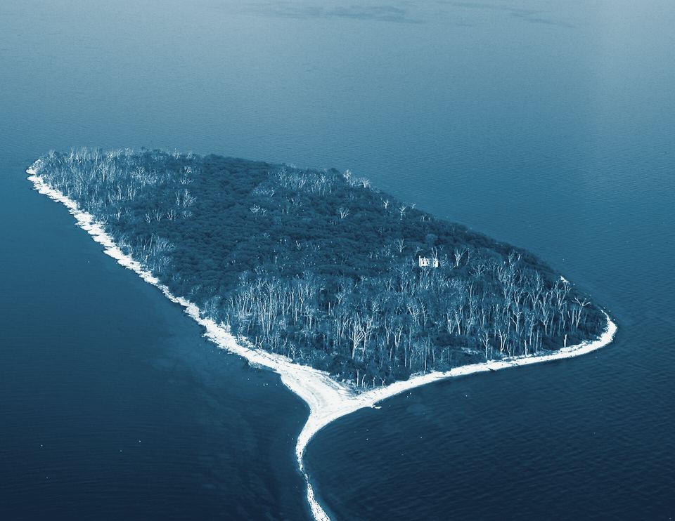
Middle Island, the southernmost point of land in Canada, once had its own lighthouse. The 1872 wooden tower went dark around 1918 and later burned, leaving only a stone foundation among the trees of an island that is now part of Point Pelee National Park.
History
Middle Island is a small island in the western basin of Lake Erie, just on the Canadian side of the international border. It is the southernmost point of land in Canada, lying about 11 kilometres east of Ohio's Middle Bass Island.[1,2]
A lighthouse was built on the island in 1872. It was a square pyramidal wooden tower about 15 metres (49 feet) tall, attached to a keeper's house.[2,1] The light fell out of use by 1918.[2,1] Some time afterwards the tower burned; the Lighthouse Directory places the fire after 1955.[1] Today only the stone foundation can be seen, along with a wooden shed in poor condition, and trees hide the site from above.[1]
The island's later history is unusual. Although it lies in Canadian waters and is unquestionably Canadian territory, it was owned for many years by a series of American owners.[2] In 1999 the Nature Conservancy of Canada bought it, and in 2000 the island was donated to the national park system, becoming part of Point Pelee National Park.[2,1]
Point Pelee National Park, on the nearby mainland, describes itself as Canada's second-smallest national park and among its most ecologically diverse, and it sits at the southernmost tip of the Canadian mainland.[3] Middle Island, its offshore outlier, is reached only by boat.[1] Little of the lighthouse survives beyond its stone foundation, but the island marks a notable geographic point: it is the southernmost land in Canada, its southern tip only about 150 metres from the U.S. maritime boundary.[2,1]
How to see it
Ruin or relocated Only ruins remain, or the tower has been moved from its original site.
- Best public viewpoint
- From a boat; only the stone foundation remains, hidden among trees on the island.[1]
- Tower climbs
- No public tower climbs have been offered, as far as our sources show.
- Operator
- Parks Canada
- Last verified
- Last verified 2026-10
Access details last verified 2026-10. Hours, tours and ownership change. Check the operator before you go. Pier and breakwater lights can be dangerous in wind and waves; obey posted closures and never enter private or Coast Guard property.
Questions people ask
Is there anything left of the Middle Island lighthouse?
Only the stone foundation and a decaying wooden shed. The 1872 wooden tower went out of use by 1918 and later burned.
Where is the southernmost point of Canada?
Middle Island in Lake Erie, now part of Point Pelee National Park. It lies about 11 km east of Middle Bass Island, Ohio.
Nearby lighthouses
- South Bass Island Lighthouse Tower climbs
- Green Island Lighthouse Ruin or relocated
- Marblehead Lighthouse Tower climbs
- Pelee Island Lighthouse Grounds open
- Pelee Passage Lighthouse View from a boat
Nearby shipwrecks
Nearby · Sponsored
Run a heritage-tourism business near Middle Island Lighthouse (ruin)? Sponsor this page: $79/year. Sponsor this page

Sources
- Lighthouses of Canada: Southwestern Ontario, Russ Rowlett, The Lighthouse Directory (University of North Carolina at Chapel Hill). Accessed .
- Middle Island (Lake Erie), Wikipedia. Accessed .
- Point Pelee National Park, Parks Canada. Accessed .
Page checked . Spotted an error? Send a correction.